Al-Arabia – The Pentagon on Thursday released an image it said showed the flight path for the drone that was shot down by Iran, but did not immediately provide a detailed explanation of the image.
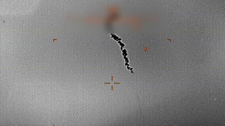
The US release of the image appeared to be an effort to bolster its case that the drone was shot down in international airspace.
Tehran said it was on a spy mission over its territory and was shot down in Iranian airspace.
A US official said the drone was a US Navy MQ-4C Triton.
“Iranian reports that the aircraft was over Iran are false,” said Navy Captain Bill Urban, a spokesman for the US military’s Central Command.
“This was an unprovoked attack on a US surveillance asset in international airspace,” he added.
US President Donald Trump will be meeting later on Thursday with senior Pentagon officials to determine the nature of the response against Iran.
Lieutenant General Joseph T. Guastella, speaking from al-Udeid air base in Qatar, said in a Pentagon briefing that the US drone did not enter Iranian airspace, adding that Iran’s downing was “escalatory” and “irresponsible.”
The aircraft’s manufacturer, Northrop Grumman, says on its website that the Triton can fly for over 24 hours at a time, at altitudes higher than 10 miles, with an operational range of 8,200 nautical miles.